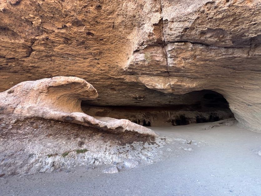
The Wave Cave is a beautiful cave located in Gold Canyon, Arizona, just east of Phoenix. Relying on Google Maps to take you there can be a bit confusing since this isn’t a well marked trail (at all) and there is no “Wave Cave” trail head. So I am going to be talking you through everything you need to know when preparing for this hike.
- Parking
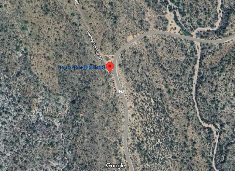
- As mentioned above, there is no trail head, map, or parking lot for the wave cave; however, there is a parking lot that will lead you in the right direction. You need to park at Carney Springs Trailhead. This is a small parking lot that only fits about 20 cars, so it is first come first serve.
- If Carney Springs Trailhead is full, you can park down the road at Lost Gold mine Trailhead, or Peralta Trailhead
- Permit
- You will be required to buy a permit online before hiking. It is rather easy and I suggest buying it at home, because you might not have reception in the mountains. This permit is for each person, and has nothing to do with your vehicle.
- They cost $15 per person or $15 for a small group.
- I did not see anyone checking for permits on the trail or at the trail head, but I can imagine the fine would be rather hefty.
- Road Conditions
- Just a heads up (since no one told me) the road to the trail head from the city of Gold Canyon is gravel/dirt. However, it is well maintained and I had no problem driving my 2-wheel-drive car at 30mph. The road does become increasingly rough after the East Goldmine Trail head, if you make it that far.

- Just a heads up (since no one told me) the road to the trail head from the city of Gold Canyon is gravel/dirt. However, it is well maintained and I had no problem driving my 2-wheel-drive car at 30mph. The road does become increasingly rough after the East Goldmine Trail head, if you make it that far.
- Trail Map
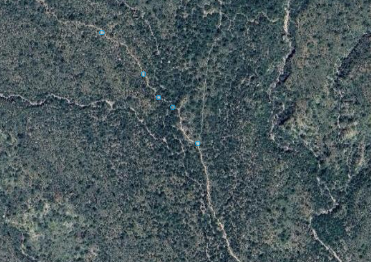
- As Mentioned above, the trail is not marked, at all. The trail starts off wide, and is easy to follow. When you reach the fence–walk straight. Around the .08 mile mark there will be a split in the trail… go left!
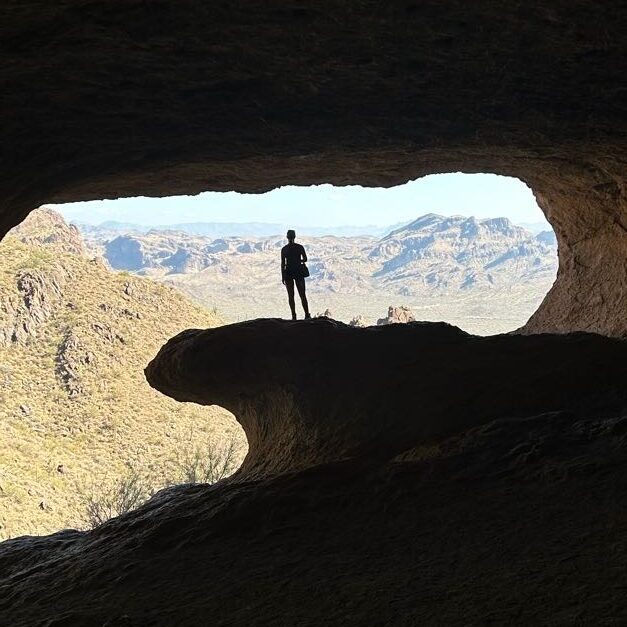
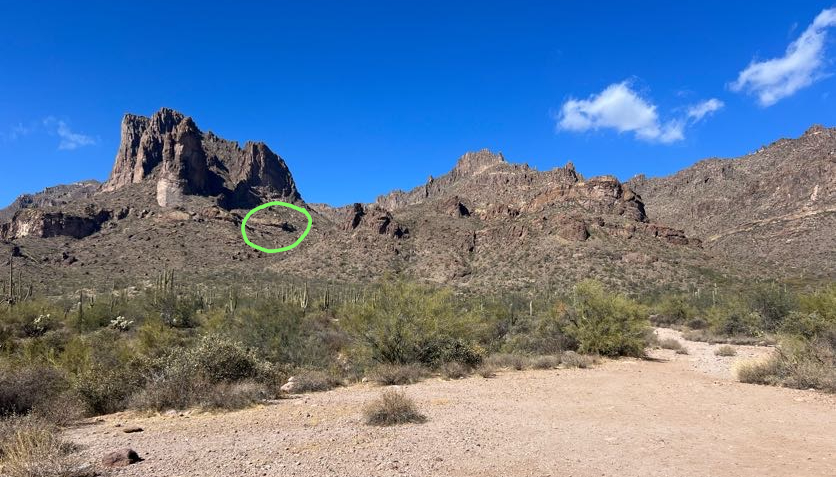
- You can see the cave from the trail head! It looks tiny from afar, but keeping that insight will help you determine if you have taken a wrong turn.
- When in doubt, go left!
*The image below is the exact spot where I took a right instead of a left. The blue dots are where the trail continues and where you follow. I was using a hiking app to follow the trail and it told me to go left further up the trail, but there was no turn. That’s when I turned it off and finished my hike using GoogleMaps.
- Difficulty
- The cave is about half way up the mountain, making it seem like the hike shouldn’t be very difficult–wrong! This hike has almost 1000 feet of elevation gain and you are unknowingly going at a slight incline at the start. Once the elevation starts to pick up, the hike becomes increasingly rocky with a few sections of scrambling, but if you are a confident hiker, this shouldn’t be a problem.
- To me, the most dangerous part of this hike is all the loose dirt and sand that sits on top of the rocks. Going up isn’t much of a problem, but I saw a few people slip on the way down.
Overall, the wave cave in a moderately difficult route with a few sections of scrambling near the top. It is an exposed trail outside of the city so please, bring plenty of water. Also, don’t forget your permit.